KBSE is a trusted provider of South Remote Sensing solutions in Pakistan, offering high-precision geospatial data for a wide range of applications. With a strong commitment to quality and innovation, KBSE delivers reliable remote sensing services that support accurate mapping, monitoring, and analysis. Their solutions are designed to meet the growing needs of industries such as agriculture, urban planning, and environmental management. Backed by expert knowledge and advanced technology, KBSE ensures efficient data acquisition and interpretation. Clients rely on KBSE for timely and actionable insights. As a leading name in the field, KBSE continues to set the standard for remote sensing excellence in southern Pakistan.
Direct geo-referencing, amazing cm-level accuracy, backpack 3-in-1 magic , abundant software functions.
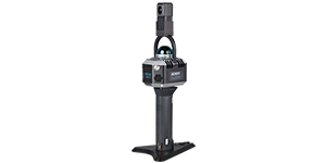
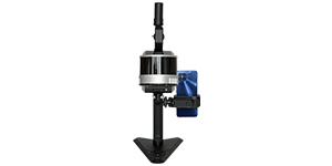
A compact unit, 1.29kg only, Live cloud and trajectory, Max. measuring range 70m, One-key to color point cloud.